The Medieval March of Wales – a five-year research project

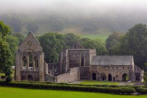
The Cistercian Valle Crucis Abbey near Llangollen.

A five-year research project to explore the history and literature of the medieval March of Wales began on 1 May 2023, based at the University of Bristol. The project is called ‘The Medieval March of Wales, c. 1282–1550: Mapping Literary Geography in a British Border Region’, known as MOWLIT for short.

The project aims to create the first cultural history of the medieval March of Wales, the borderlands between Wales and England, occupied by a diverse population of Welsh, English and French speakers in the period between 1282 and 1550. The main objectives are to uncover and analyse the literary texts and manuscripts produced and circulated in the medieval March, and to create an original series of digital maps of the Marcher lordships at various date points during the period. The texts and the maps will be linked by means of a prosopography, a visualisation of the major gentry houses and abbeys, and a distribution of the texts/manuscripts across the maps showing where they were produced and who read/owned them. These resources will enable an assessment of the cultural and regional identities of the March and its relations with its more powerful neighbour, England.

The project team includes heritage and mapping specialists from the Royal Commission of Ancient and Historic Monuments in Wales and digital humanities specialists from Research IT at the University of Bristol. The project will employ two full-time postdoctoral research assistants and an administrator, and will support a PhD studentship. Outcomes from the project include a monograph, two edited collections, digital and printed maps, and a PhD thesis suitable for publication. You can read more about the project at the MOWLIT website which we have recently set up and which will be added to with new materials at regular intervals.

The project was originally awarded funding through the ERC Advanced Grant scheme and is now funded through the UKRI guarantee.

We aim to engage with local history groups, museums, creative practitioners and other stakeholders with an interest in the region of the March and its history. Please get in touch if you would like to be added to the mailing list to be kept up to date with the project and its activities.

Helen

Helen.fulton@bristol.ac.uk

Project team image


First bilingual map of a Welsh town – Swansea and the Mumbles

The Historic Towns Trust published the Historic Maps of Swansea and the Mumbles / Mapiau Hanesyddol Abertawe a’r Mwmbwls in April 2023. The two maps, one in English and one in Welsh, were launched at Swansea Museum on 20 May 2023.

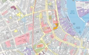
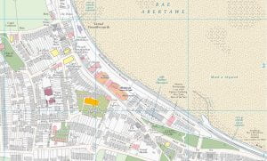
The maps show the whole of the central Swansea city area, together with maps of the industrial valley and of the village of Mumbles to the west of the city. The streetscape of medieval Swansea can be seen alongside later developments during Swansea’s heyday as a busy industrial centre from the eighteenth up to the beginning of the twentieth century.

The English map was edited by Helen Fulton and Giles Darkes (Historic Towns Trust) and the Welsh map was edited by Helen Fulton, Giles Darkes, and Geraint Evans (Swansea University). The maps were funded by grants from the University of Bristol and Swansea University, with additional donations from the Gower Society and a number of individuals. The research assistant on the project was Dr Ben Curtis.

The Welsh map is the first of its kind – a map in Welsh of a Welsh town – and the Historic Towns Trust hopes to publish more such bilingual maps. The maps can be purchased through any physical or online bookshop such as Waterstones.

These images show (left) a snapshot of central Swansea from the English map, and (right) a snapshot of the Mumbles from the Welsh map. For further enquiries, contact Helen.fulton@bristol.ac.uk


A new historic map of Swansea

The Historic Towns Trust is planning to produce a historic map of Swansea and the Mumbles, showing the layout of the city in its medieval and industrial past. Swansea was a major medieval town, part of the lordship of Glamorgan, with a castle whose ruins still dominate the city centre. Much of the Norman castle of Oystermouth, in the Mumbles, survives and remains a big attraction to locals and tourists. In the modern era, Swansea’s economy was industrial, with a thriving port and a big copper works in the nineteenth century. By focusing on these two historical periods, the map will capture Swansea and the Mumbles at times of economic growth, showing the city’s ability to use its unique location and resources to renew itself with energy and vision.

There is a fundraising campaign associated with the map, to cover the costs of research, cartography, and printing. To support the campaign, download the attached flyer. For further details, email helen.fulton@bristol.ac.uk

Loader Loading...
EAD Logo Taking too long?

Reload Reload document
| Open Open in new tab

Download

Map of Bristol 1480

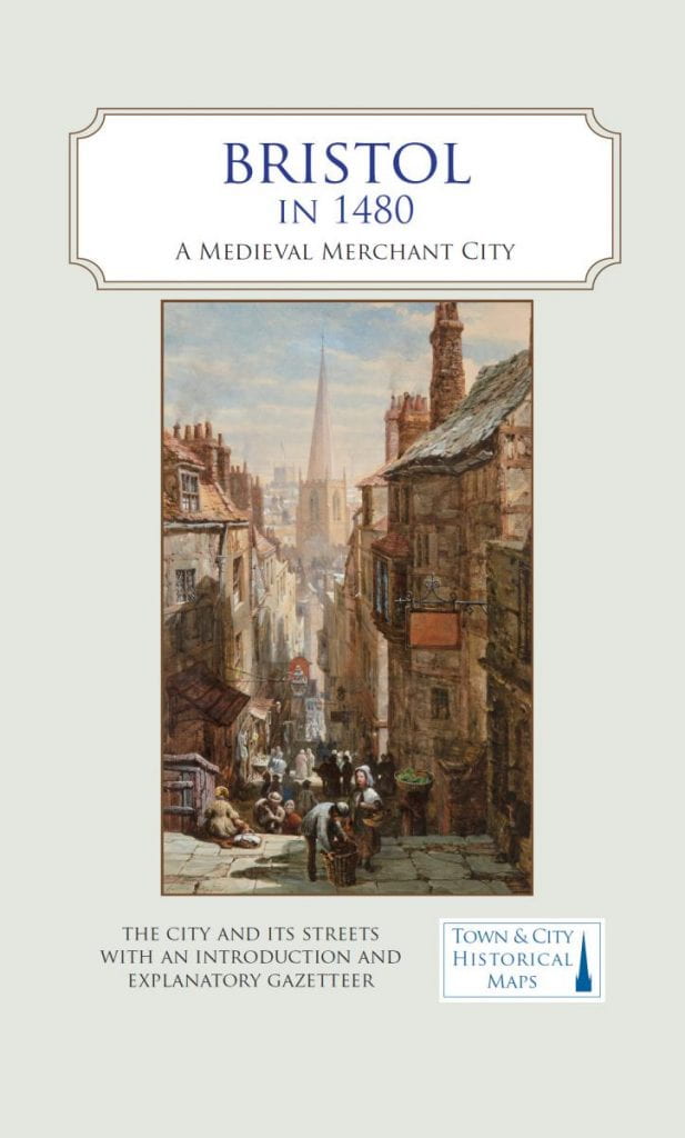
The Historic Towns Trust, supported by funding from the University of Bristol and local history societies, has published A Map of Bristol in 1480: A Medieval Merchant City. The map is a reconstruction of the city as it was described by William Worcestre, a high ranking official who was a native of Bristol and described its streets and buildings in great detail. Worcestre’s description, combined with archaeological information and extensive historical research, has allowed a team of leading Bristol historians and archaeologists to reconstruct Worcestre’s Bristol. The map is printed on a single fold-out sheet with an OS map of 1918 in the background. On the reverse is a detailed description of the churches, religious houses, castle walls, inns, taverns, and houses belonging to the most prosperous merchants in this major port town. The project was led by Professor Helen Fulton (University of Bristol) as part of ‘Making Bristol Medieval’, funded by the Research Enterprise Development Knowledge Exchange Fund. The cartography and design were by Giles Darkes of the Historic Towns Trust and the introduction was written by Professor Peter Fleming (University of the West of England). Research for the map was undertaken by Dr Robert H. Jones (formerly Bristol City Council), Dr Pete Insole (Bristol City Council), Professor Roger Leech (University of Southampton), and Dr Bethany Whalley (University of Bristol). The map is £9.99 and can be ordered from bookshops using the ISBN 978-0-9934698-7-9.


Helen Fulton wins Leverhulme Major Research Fellowship

Helen Fulton has been awarded a Leverhulme Major Research Fellowship from 2020–2022 to work on a project called ‘Medieval Welsh Political Poetry’.

The project will result in an edition of medieval Welsh poetry that throws light on the politics of Wales and England in the fourteenth and fifteenth centuries, and a study of the Welsh Marcher lord, Sir William Herbert, who played a key role as a Yorkist in the Wars of the Roses. Read more.

York Digital Image Studio Photography

Announcing a new Borders and Borderlands project: Making Bristol Medieval

We’re delighted to announce that Borders and Borderlands has won a grant of £11,173 from the Research and Enterprise Knowledge Exchange fund at the University of Bristol for the project ‘Making Bristol Medieval’.

The aim of the project is to highlight Bristol’s medieval past as a major political and commercial centre with an early interest in the potential of Atlantic trade routes. One of the major outputs of the project is a map of medieval Bristol in the year 1480, to be published in association with the Historic Towns Trust. The project runs from February to July 2020, and the PDRA is Dr Bethany Whalley. Read more.

Border Geographies in Medieval European Writing

Helen Fulton has launched a new international network, ‘Border Geographies in Medieval European Writing’, with funding from the International Strategic Fund from the University of Bristol. The funding enabled Helen to travel to the University of Sydney in June 2019 to talk to colleagues at their Medieval and Early Modern Centre (MEMC).

Helen’s main partner is Dr Jan Shaw, University of Sydney, who visited Bristol as a Benjamin Meaker Visiting Professor in April 2018.

Benjamin Meaker Visiting Professorship: Population and Cultural Movement Round the Medieval Atlantic Borderlands

We are pleased to be hosting Professor Benjamin Hudson from Pennsylvania State University at the Centre for Medieval Studies at Bristol from May-June 2019. His visit is funded by a Benjamin Meaker Visiting Professorship, sponsored by the Borders and Borderlands cluster.

Professor Hudson’s project is called ‘Population and Cultural Movement Round the Medieval Atlantic Borderlands’ and he will be delivering a graduate seminar and a public lecture titled ‘The Early History of the Atlantic Ocean: Why Bother?’, on 16 May 2019. Read more.